
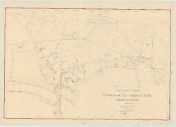
Saint-André-De-L'Eure _ MRU _ Plan topographique régulier du hameau de Ferrière
7 Pl 37
,
1946
,
Saint-André-de-l'Eure (Eure, France) ; Ferrière (Eure, France)
par M. BACHELIN, géomètre _ 1946 _ Imprimé, papier, encre noir et bistre, échelle : 1/1000e _ 106 x 75
Contexte :