


Pont-Audemer _ CTRI _ Fond de plan topographique en 5 feuilles
-
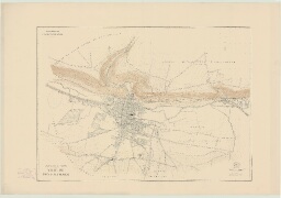
Description :
par R. GUITONNEAU, géomètre _ 1942 _ Imprimé, papier, encre noir et bistre, échelle 1 : 1/5000e, échelle 2-5 : 1/2000e _ 1- Plan général _ 111 x 76 _ _ 2- Feuille 1 _ 111 x 81,5 _ _ 3- Feuille 2 _ 108,3 x 81,2 _ _ 4- Feuille 3 _ 113,5 x 82 _ _ 5- Feuille 4 _ 111,5 x 82,5
-
Date :
1942
-
Identifiant :
7 Pl 33
- Localité : Pont-Audemer (Eure, France)