Saint-Pierre-Du-Vauvray _ CTRI _ Fond de plan topographique
-
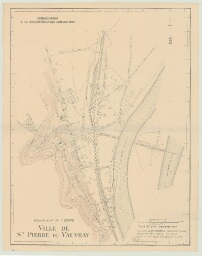
Description :
par R. GUITONNEAU, géomètre _ 1941 _ Imprimé, papier, encre noir et bistre, échelle : 1/2000e _ 70,2 x 88,5
-
Date :
1941
-
Identifiant :
7 Pl 40
- Localité : Saint-Pierre-du-Vauvray (Eure, France)