![/medias/customer_2/cadastre/3p6/3P6_490/FRAD027_3P6_490_0001_jpg_/0_0.jpg](/medias/customer_2/cadastre/3p6/3P6_490/FRAD027_3P6_490_0001_jpg_/0_0.jpg)
![/medias/customer_2/cadastre/3p6/3P6_490/FRAD027_3P6_490_0002_jpg_/0_0.jpg](/medias/customer_2/cadastre/3p6/3P6_490/FRAD027_3P6_490_0002_jpg_/0_0.jpg)
![/medias/customer_2/cadastre/3p6/3P6_490/FRAD027_3P6_490_0003_jpg_/0_0.jpg](/medias/customer_2/cadastre/3p6/3P6_490/FRAD027_3P6_490_0003_jpg_/0_0.jpg)
![/medias/customer_2/cadastre/3p6/3P6_490/FRAD027_3P6_490_0004_jpg_/0_0.jpg](/medias/customer_2/cadastre/3p6/3P6_490/FRAD027_3P6_490_0004_jpg_/0_0.jpg)
![/medias/customer_2/cadastre/3p6/3P6_490/FRAD027_3P6_490_0005_jpg_/0_0.jpg](/medias/customer_2/cadastre/3p6/3P6_490/FRAD027_3P6_490_0005_jpg_/0_0.jpg)
![/medias/customer_2/cadastre/3p6/3P6_490/FRAD027_3P6_490_0006_jpg_/0_0.jpg](/medias/customer_2/cadastre/3p6/3P6_490/FRAD027_3P6_490_0006_jpg_/0_0.jpg)
![/medias/customer_2/cadastre/3p6/3P6_490/FRAD027_3P6_490_0007_jpg_/0_0.jpg](/medias/customer_2/cadastre/3p6/3P6_490/FRAD027_3P6_490_0007_jpg_/0_0.jpg)
![/medias/customer_2/cadastre/3p6/3P6_490/FRAD027_3P6_490_0008_jpg_/0_0.jpg](/medias/customer_2/cadastre/3p6/3P6_490/FRAD027_3P6_490_0008_jpg_/0_0.jpg)
![/medias/customer_2/cadastre/3p6/3P6_490/FRAD027_3P6_490_0009_jpg_/0_0.jpg](/medias/customer_2/cadastre/3p6/3P6_490/FRAD027_3P6_490_0009_jpg_/0_0.jpg)
![/medias/customer_2/cadastre/3p6/3P6_490/FRAD027_3P6_490_0010_jpg_/0_0.jpg](/medias/customer_2/cadastre/3p6/3P6_490/FRAD027_3P6_490_0010_jpg_/0_0.jpg)
Martagny
-
Description :
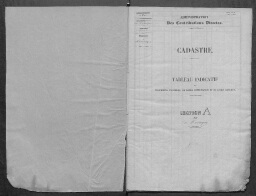
1843 Tableau indicatif des propriétés foncières
-
Date :
1843
- Nature du contenu : Etats de section
-
Identifiant :
3 P 6 490
- Localité : Martagny (Eure, France)